Free app for iPhone and Android
Madeira: the island app with a 3D map
Weather place by place, the official trail statuses, beaches, places for children, events, cruise ships, webcams and a written guide, on a 3D model of Madeira. Free, no account, no adverts, and it keeps working without signal.

- Works without signal
- No account, no tracking
What the app does
A 3D island you can turn
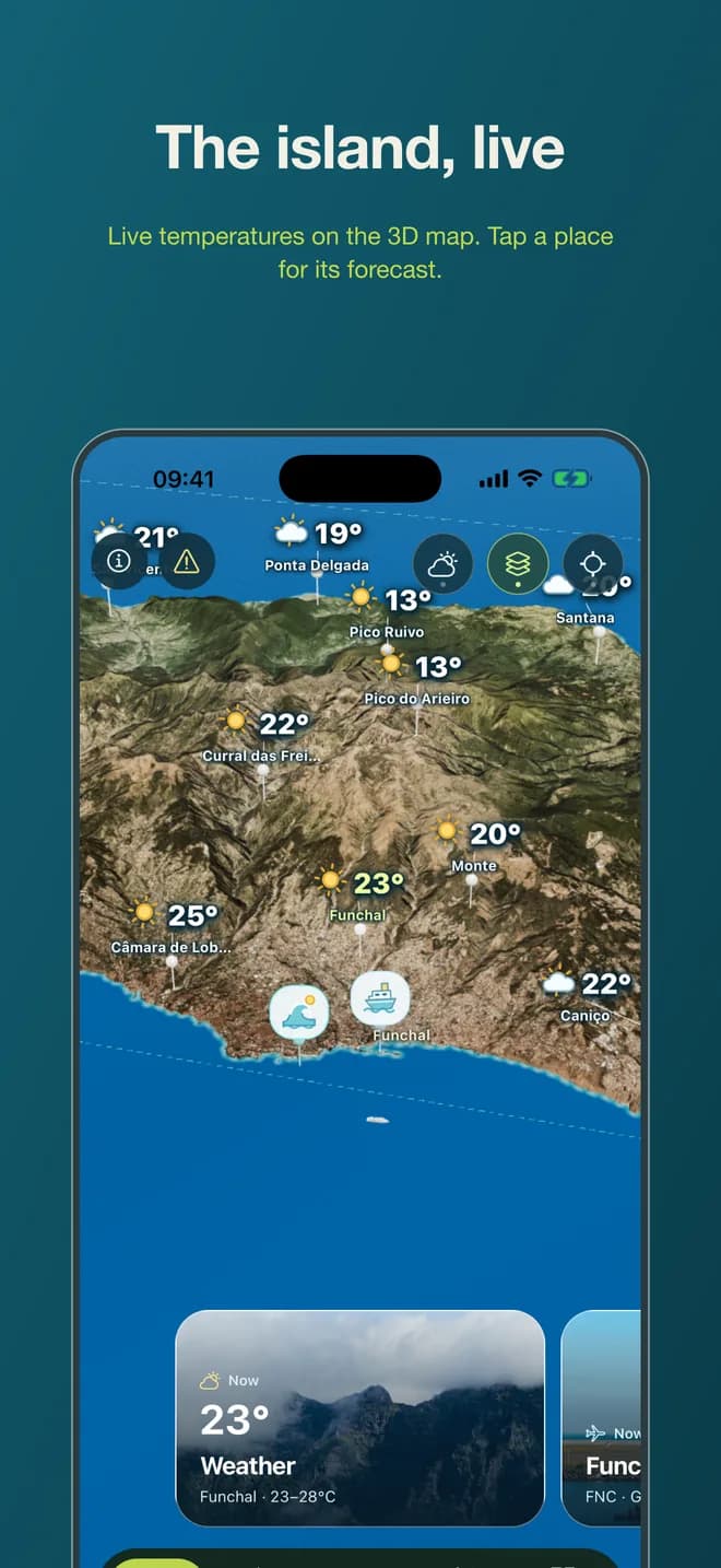
Madeira as a relief model with the real terrain, roads and towns. Weather, trails, beaches and cameras sit where they are on the island, so distances and climbs make sense before you set off.
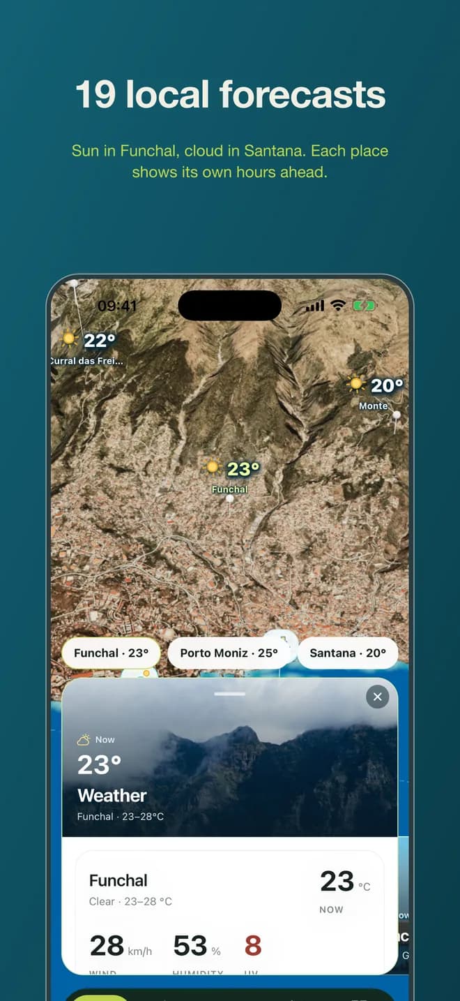
Weather for nineteen places
The north can be in cloud while Funchal is in sun. Each place has its own forecast with the hours ahead, and the app suggests which day suits which outing.
Official trail statuses
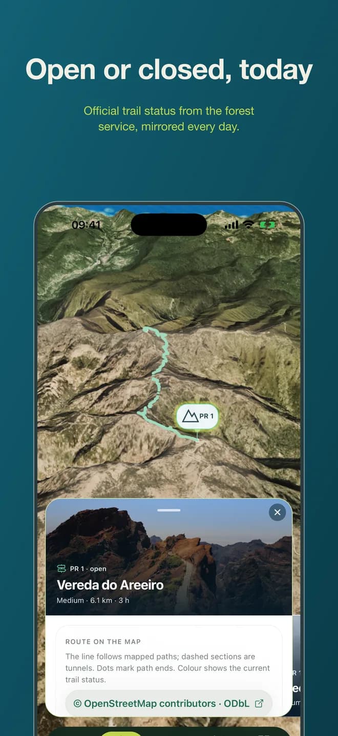
What is open, restricted or closed on the PR trails, mirrored daily from the official list, with where each walk starts and how to book the ones that need it.
Beaches and lidos
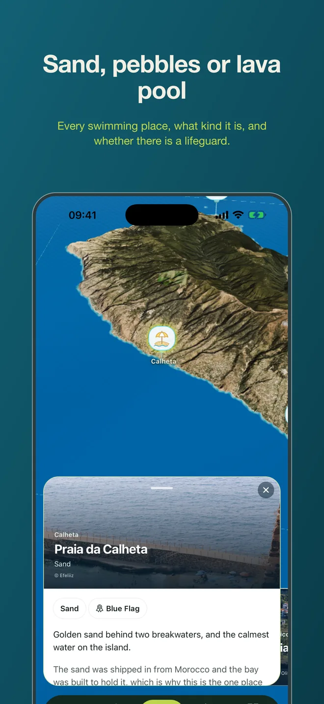
Sand, pebbles, lava pools and sea-water lidos, with what each one actually is, whether there are lifeguards, and directions.
Things to do with children
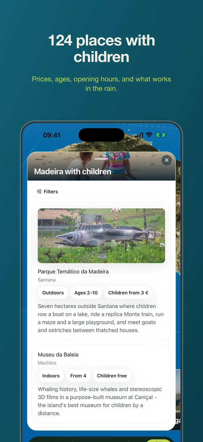
124 places checked against the operators' own pages: prices, ages, opening hours, and whether it works in the rain.
What is on today
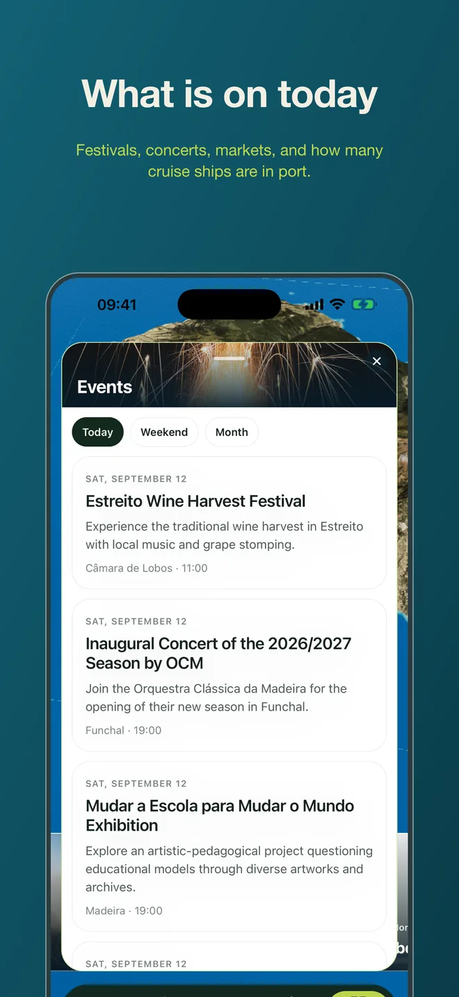
Festivals, concerts, markets and village feasts, with a reminder on the morning of the ones you save.
Airport wind
The gusts at Funchal airport, hour by hour, three days out: the one number that decides whether a landing goes around.
Ships, webcams, sunrise, tides
Cruise ships in port by day, live cameras around the island, the odds of a sunrise above the clouds at Pico do Arieiro, and the tides.
A written guide
Getting around, what things cost, what to do when it rains: the guide from this site, cached on the phone.
What is free and what costs money
Free
Everything above: the 3D map, weather, trail statuses, beaches, places for children, events, airport wind, ships, webcams, sunrise, tides and the guide. No account, no adverts, no subscription.
Paid: trip programmes
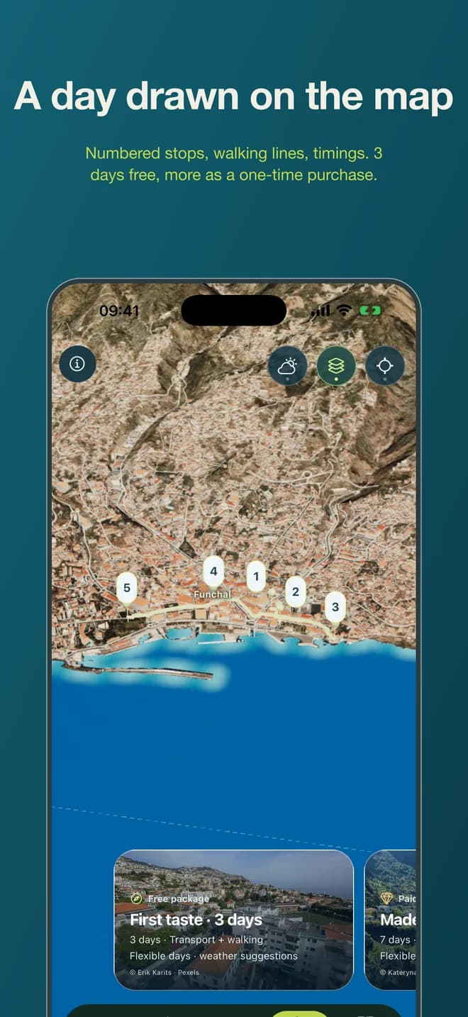
Eight ready-made programmes for a stay of 3 to 10 days, with days planned around the weather, transport worked out and alternatives for when a trail closes. One is free; the other seven are a one-off purchase of about €9.99 each, paid through the App Store or Google Play. Nothing else in the app is locked.
Works without signal
Every screen you have opened stays on the phone: the statuses, the forecast, the beaches, the guide. Half of Madeira's roads have no signal, and that is where the answers are needed. Trail geometry and the island model can be downloaded in advance.
No account, no tracking
There is nothing to sign up for. The app has no advertising, no advertising identifiers and no tracking across other apps. Usage statistics are collected only if you say yes when asked, and go to a server in the EU. Your location is drawn on the map and never leaves the phone.
Screens from the app
Questions
- Is the app really free?
- Yes. Everything except the seven paid trip programmes is free, with no adverts and no subscription. The programmes are optional one-off purchases of about €9.99 each.
- Does it work without internet?
- Yes, for everything you have opened at least once. Weather, trail statuses and events refresh when there is signal; the map, the guide and the catalogues are stored on the phone.
- Which languages?
- English, German and Russian. The app follows the phone's language and can be switched in its settings.
- Which phones?
- iPhones with a recent iOS and Android phones with a recent Android. There is no tablet or desktop version; the website covers those.
- Is it a hiking navigator?
- No. It shows each PR trail on the 3D island with its official status, start point and booking information, and can open your navigation app for the drive there. It does not guide you step by step on the trail.
- Where do the data come from?
- Weather from IPMA and Open-Meteo, trail statuses from the official IFCN list, ship calls from the port authority, events from the organisers' own announcements. The same sources as this website.
Get the app
Scan the code with your phone, or open this page on it: the buttons take you to the right store.
At a glance
- appPromo.page.name
- Madeira: weather & trails
- appPromo.page.platforms
- iPhone (iOS), Android
- appPromo.page.price
- Free; optional trip programmes at about €9.99 each, one-off
- appPromo.page.languages
- English, German, Russian
- appPromo.page.publisher
- DENIS.PT, UNIPESSOAL LDA, Funchal, Madeira
- appPromo.page.ids
- App Store id6810709497 · Google Play com.madeira1.app
- appPromo.page.data
- No account. Anonymous usage statistics only with consent. No advertising SDKs.